Category Archives: Users

Kromme Rijn Collective management

Kromme Rijn Collective management

Summary

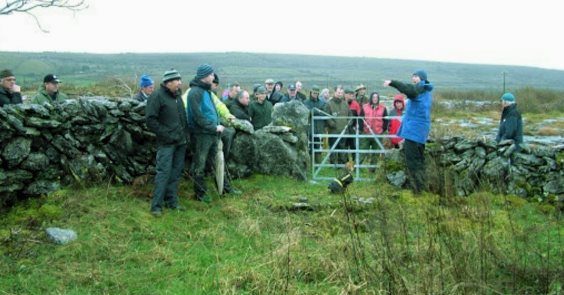
Collective implementation of agri-environmental management has been started up throughout the Netherlands since 2016. After individual management had proven to fail to deliver the desired agri-environmental-climate public goods (AECPGs), a larger-scale implementation of agri-environmental management was considered a more feasible and promising solution. In the central Dutch province of Utrecht, a wide variety of AECPGs is required by society and farmers. This includes improvement of water quality, enhancing and emphasizing the landscape diversity that supports recreation, and providing a habitat for species including bats and owls. In the eastern half of the province, the Kromme Rijn region, the “Agrarisch Natuur Collectief Utrecht Oost” (agricultural nature collective Utrecht East) organizes the large-scale nature management. Land owners are members of the collective, which organizes payment for specific nature management actions performed by farmers, monitors, and brokers between land owners and organizations / companies that implement some specific nature management actions, based on a common regional management plan. The collective is certified by the national certification institute for agri- environmental management and has its own quality assurance controllers.

Objectives

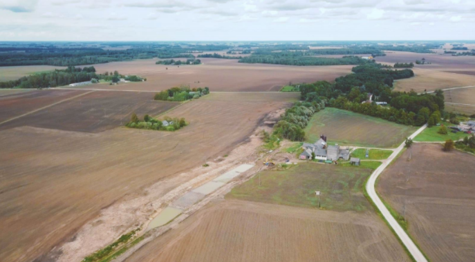
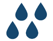
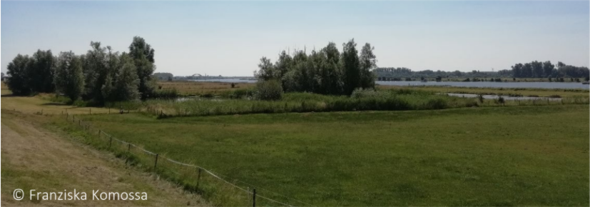
Objectives are set by the provinces. In the case of Kromme Rijn, the province of Utrecht defines targets in its annual nature management plan. Defined are targets for nature, landscape, agricultural nature and landscape management. Landscape management targets at fostering landscape diversity. The ANLM aims at maintaining landscape elements: characteristic on the levees are tree lines, small patches of forests, wooded banks, ponds, and small traditional orchards. The lower and wetter part of the region.
Langbroekerwetering, contains small patches of wet species-rich grasslands that are extensively managed through mowing, combined with tree lines and small fields.
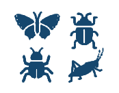
Creating habitat for amphibians, including the great crested newt, for several owls, and several bat species. Creating habitats for threatened species of extensive traditional arable lands.

Public Goods

Water quality
Water quality
Water quality
(Farmland) biodiversity
Cultural heritage
Soil quality (and health)
Landscape and scenery

Problem description

Agri-environmental management has been introduced in the Netherlands in 1975.
1000 km2 were assigned as agriculture-nature area and managed by nature organizations, another 1000 km2 included “normal” farmland, on which farmers planned their farmland and management practices in a nature-friendly way. Since the year 2000, it became increasingly apparent that farm-level agri-environmental management was not effective, because target species required a larger mosaic of land use and land cover than can be provided on a single farm. In 2016, agri- environmental management by nature collectives has been introduced by the Dutch government

Your participation is important for the CONSOLE project

Your participation is important for the CONSOLE project

Both the blog post as in the social media profiles (Facebook, Twitter or LinkedIn) of the CONSOLE project, we want to pay tribute to all those people who make it possible for our project to be a success

On previous occasions we have defined what the Community of Practice (CoP) is and how important it is; which is represented by those actors who are involved in the project (farmers and foresters, experts, project partners, representatives of public administrations, etc.).

Its objective is to facilitate the exchange of knowledge and mutual learning, based on the principle of reciprocity. As described in Deliverable 5.1. it is about << ensuring sound management and facilitation of the CoP by all CONSOLE partners in order to optimize the contributions of CoP members in project activities >>.

Because the development of an efficient CoP requires the promotion of exchanges, taking into account the interests and needs of the stakeholders involved and encouraging them to share their experience.

And all of this will be done through dedicated training activities to ensure the major transition to smarter AECPGs practices in Europe.

We encourage you to check Deliverable 5.1. where, in addition, we specify all the tasks, activities and communication channels that allow us to achieve the planned objectives.

Download

And what an easier way to consult the documentation, than by clicking the button

Nutriflow_baner

NUTRINFLOW

Summary

The project aimed at establishing good practical examples of win-win measures for agricultural producers in water management for the retention of nitrogen and phosphorus. Through working with farmers and landowners, the project promotes and demonstrates with concrete investments the benefits gained from holistic planning and coordinated implementation of water retention and on-farm drainage management measures. To show good practice examples on the Ailes stream a project was developed and contracts with landowners signed. The overall project was lead by Proagria (Finland). Union “Farmers Parliament” (Latvia) was one of the project partners.

Objectives

  • Control and reduce nutrient inputs into natural watercourses and water bodies;
  • Control soil erosion;
  • Enrich oxygen content in water;
  • Promote natural self-purification processes in water;
  • Increase awareness among farmers, advisors and municipal authorities and services on drainage techniques and approaches to integrate field and basic drainage measures while lowering the barriers for the execution of sustainable drainage management and combination of environmental and production benefits.

Public Goods

Water quality

Problem description

The project responded to the common pan-Baltic challenge to implement more effective and acceptable measures to reduce nutrient inflows to the surface waters and the Baltic Sea from agriculture. It is evident from recent history of implementing on-farm agri-environment measures, that they have not yielded the results needed in terms of reduced nutrient losses and that complementary measures in the drainage network and landscape are needed. In part, this is due to the multifaceted hydro-morphological, physical and biochemical processes in the soil and the aquatic environment, which also makes the effect of these individual measures difficult to measure. Through addressing water flow, water storage and retention it is possible to tackle the problem of nutrient losses outside the growing season when there is no uptake by the crops. According to studies and estimates, up to 90% of nutrients are lost outside growing season which indicates great potential for
nutrient loss reductions by the above mentioned measures. At the same time, there is great potential to be gained for agricultural production, but also for the production of ecosystem services for the society from measures targeting water flows and retention in the landscape.
Through a holistic catchment level management, an optimal combination of measures in the landscape, the stream network and on farm could ensure sustainability and viability of agriculture while reducing the external nutrient loading to the sea. The fact that the project’s partner countries are faced with the need to renovate agricultural drainage infrastructure, provides an ideal ground to introduce new, more sustainable measures to meet the needs of agricultural production and the aquatic environment. Attention to sustainable drainage management is especially critical in the foreseeable climate change with increased precipitation and on the other hand increased summertime water shortages.

Incentives for collective reservoirs

Incentives for collective reservoirs

Summary

The measure has been programmed in the RDP for the 2007 – 2013 and supports the construction of collective small-medium irrigation reservoirs. The objective is twofold: 1) to ensure a stable water supply for the agricultural sector, and 2) to reduce the pressure on groundwater resources. The support is in the form of partial coverage of construction costs and it is granted if the candidate projects involve a minimum number of farmers and/or water stored (even though the thresholds have changed over the years). In the Ravenna province, there is the largest number of measure applicants. In such an area the Consorzio di Bonifica della Romagna Occidentale (Land Reclamation Board of Western Romagna) has proved a key actor in the management of such projects, coordinating farmers demand and providing technical assistances.

Objectives

  • To ensure a stable water supply for the agricultural sector;
  • To reduce the pressure on groundwater resources.

Public Goods

Water quantity

Problem description

The measure has the double objective of ensuring a stable water supply for the agricultural sector, and at the same time the reduction of groundwater consumption.

How to do better research by looking beyond

How to do better research by looking beyond

If you have browsed through the CONSOLE project website, you will know that we have not only developed Case Studies at a European level, but that the CONSOLE project partners have developed research beyond the borders of Europe.

These Case Studies have been collected in an independent document (deliverable 2.2) by the teams of UNIBO, BOKU, LUKE and TRAME, because they have a fundamental value for the CONSOLE project

Thus, the objective of the research was to collect the most promising experiences and successful outside the European Union, which could offer interesting (enriching) perspectives for its application in the European Union to feed the Work Package 2  a wider range of opportunities in contract designs.

And to achieve this, these partners carried out a systematic review of the assistant literature, specifically of 79 documents (scientific articles, reports, “gray” literature, etc.), aimed at addressing voluntary contracts that address solutions for the provision of Agri-environmental Public Goods (AECPGs)

 The main reasons for success identified were:

  •  Reducing risks linked to results;
  •  Reduced costs to monitor results;
  •  Farmer interest and social income;
  •  Availability of resources;
  •  Additionality;
  •  Rely on existing groups;
  •  Communication;
  •  Payment settings;
  •  Appropriate intermediaries.

Download

And what better way than to know the research developed than to read the detailed deliverable that you can download by clicking on the button.

BurrenLife Project

BurrenLife Project

Summary

Due to the unique landscape, farmers in this region face many environmental challenges which the traditional agri-environmental schemes do not address. This project works with farmers to achieve specific environmental outcomes, rewarded by payments, and also makes funds available for farmers to invest in self-selected, but pre-approved, conservation projects. Environmental targets are set and monitored by farm advisors, performance is scored and payments are made based on the scoring system..

Objectives

  • To ensure the sustainable agricultural management of HNV farmland in the Burren, improving water quality and usage, and supporting the landscape and cultural heritage of the region;
  • To preserve the culture and heritage of the region;
  • To support the economic and social sustainability of farmers.

Public Goods

Soil quality (and health)
Rural viability and vitality
Landscape and scenery
Cultural heritage
(Farmland) biodiversity
(Water quality

Problem description

The Burren extends over an estimated 72,000 ha of land in Counties Clare and Galway (Ireland). It is defined by the presence of exposed limestone, the calcium-rich skeletal remains of marine organisms that populated the seas over 340m years ago. The Burren has recently been recognized through UNESCO Geopark Status, over 30,000 ha of the Burren is designated a Special Area of Conservation (SAC) and an additional 2,000 ha designated as Special Protection Area under the Birds Directive (79/409/EEC). A study by Dunford (2001) estimated that stocking levels in the Burren increased from 0.38LU/ha in 1970 to 0.66LU/ha in 2000, a 73% increase. During this time, it is estimated that approximately 30% of the Burren’s archaeological sites were lost due to land reclamation. Silage gradually replaced the naturally available forage of the wintering pastures, resulting in reduced levels of grazing which contributed to a loss of biodiversity and accelerated levels of scrub encroachment. The initial stimulus for the project came from local farmers who, feeling threatened by SAC designations and environmental program conditions, decided to engage constructively with researchers and public authorities to find a way forward.